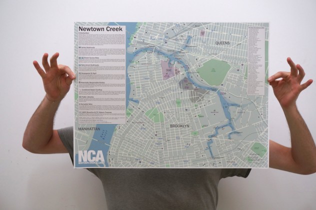
Click above to zoom in.
In 2022, NCA created a draft online interactive Google Map to highlight some key features relating to the waterway, surrounding areas, and our work to reveal, restore, and revitalize Newtown Creek.
———————-
In 2015, NCA worked closely with cartographer Ed Jacobus to create a comprehensive map of Newtown Creek. This very local guide highlights a number of key features including various infrastructure, historic industrial sites, active maritime use, access points and even the Creek as it existed circa 1600.
The map is available as a free download for personal and education purposes* (see download link below). The printed version shown above, is available to local residents and organizations at NCA sponsored events on a first-come first-served basis. Email info@newtowncreekalliance.org to get a printed copy.
Download the 24″x18″ high resolution .pdf file here.
Funding for this project was provided by the Greenpoint Community Environmental Fund via the North Brooklyn Community Boathouse.
*Unauthorized reproduction of the map for commercial purposes is strictly prohibited.
